



NAIROBI, Kenya — El Niño is already influencing weather patterns in Kenya, contributing to prolonged dry spells and unusually warm conditions in parts of the country, the Kenya Meteorological Service Authority (KMSA) has said.
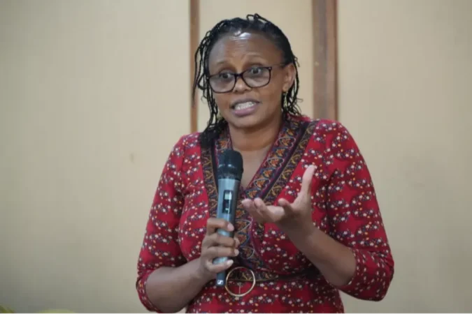
Hannah Kimani, head of Public Weather Services at KMSA, said Kenyans should not equate El Niño with rainfall or assume that the phenomenon automatically leads to flooding.
“El Niño is not coming; El Niño is already here with us. El Niño is not rainfall as most Kenyans believe. It basically changes the patterns in the whole world,” Kimani said.
She explained that El Niño occurs when sea surface temperatures in the central and eastern equatorial Pacific Ocean become warmer than normal, altering atmospheric circulation and influencing rainfall and temperature patterns around the world.
In Kenya, she said, the current El Niño has been associated with below-average rainfall in the western half of the country and the North Rift, areas that normally receive rainfall between June and September as an extension of the March-May long-rains season.
Kimani made the remarks during the fifth edition of the Annual Journalists Climate Training organised by Power Shift Africa in Kigali, Rwanda.
Why parts of Kenya have been unusually dry and warm
According to Kimani, the influence of El Niño has been evident in both rainfall and temperature patterns.
Western Kenya and the North Rift have experienced prolonged dry spells during a period when the regions would ordinarily receive more rainfall.
The phenomenon has also contributed to fluctuations in temperatures, including unusually warm days during Kenya’s June-August cold season.
“El Niño will not stop seasons from happening; it will slightly alter them. We still had cold conditions from June because we are still in the cold season, but because of El Niño we have had extremely warm days,” Kimani said.
Kenya is now approaching the October-November-December rainfall season, during which El Niño is expected to strengthen its influence and is associated with enhanced rainfall.
Kenya Met had earlier forecast an 81 per cent probability that the 2026 El Niño would be very strong and a 97 per cent probability that it would persist into early 2027.
However, Kimani cautioned against interpreting an above-normal rainfall forecast as a prediction of continuous rain or widespread flooding.
“El Niño or above-average rainfall doesn’t mean that it is going to be raining all the time. You can still have some days that are dry even when you’re having El Niño-driven rains,” she said.
Why El Niño does not automatically mean floods
Kimani said it would be scientifically unsafe to conclude that a strong El Niño would automatically produce disastrous flooding in Kenya.
The country’s rainfall is influenced by several interacting climate systems, including the Indian Ocean Dipole (IOD), Madden-Julian Oscillation (MJO) and tropical cyclones.
The IOD is particularly important for East Africa. A positive IOD occurs when waters in the western Indian Ocean near the East African coast are warmer than average while waters near Australia are cooler.
That temperature difference can influence winds and moisture transport towards East Africa, creating conditions favourable for increased rainfall.
Kimani pointed to Kenya’s climate history to illustrate why El Niño should not be used on its own to predict the severity of rainfall.
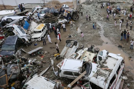
In 1997, a very strong El Niño coincided with a very strong positive IOD, contributing to the torrential rainfall that caused widespread flooding.
In contrast, the 2015 El Niño was also very strong, but Kenya did not experience rainfall on the same scale because the IOD was only weakly positive.
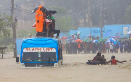
Kenya also experienced heavy rainfall in 2019 without an El Niño event. Kimani attributed the exceptional rainfall largely to a very strong positive IOD.
“I think it would be wrong for someone to say that El Niño is coming or we are having a strong El Niño, therefore we are going to have disastrous floods,” she said.
“This is not scientifically a safe conclusion because we need to look at other factors that actually lead to the torrential rains.”
She cited the March-April-May 2026 rainfall season as another example. Kenya experienced enhanced rainfall during the period despite there being no El Niño, with the MJO and a tropical cyclone contributing to the conditions.
El Niño does not create Kenya’s rainy seasons
Kimani said another widespread misconception is that El Niño itself brings Kenya’s rainfall.
The country’s main rain-bearing system is the Intertropical Convergence Zone (ITCZ), which is responsible for much of the rainfall associated with Kenya’s two main rainy seasons.
The ITCZ shifts north and south with the apparent movement of the sun, moving towards the Southern Hemisphere before the October-December short-rains season and returning northwards around March.
El Niño, the IOD and other atmospheric systems then modify the rainfall generated by the ITCZ.
“The main rain-bearing system in Kenya or in East Africa is what is called the Intertropical Convergence Zone,” Kimani said.
“The Indian Ocean Dipole and the El Niño Southern Oscillation just come to modulate or enhance the rainfall that was already brought by the Intertropical Convergence Zone.”
What ‘above-normal rainfall’ actually means
Kimani also explained that terms such as normal, above-normal and below-normal rainfall refer to statistical ranges rather than fixed amounts that apply across the entire country.
Meteorologists calculate a location’s long-term average using rainfall records covering about 30 years.
Rainfall between 75 and 125 per cent of that long-term average is classified as normal.
For example, if an area has a long-term average of 400 millimetres, rainfall between 300mm and 500mm would fall within the normal range. More than 500mm would be above normal, while less than 300mm would be below normal.
The thresholds differ from one part of Kenya to another because rainfall patterns vary according to factors such as elevation and topography.
Central and western Kenya generally receive more rainfall than arid and semi-arid areas such as Garissa, Mandera, Wajir and Lodwar.
Kenya Met therefore further breaks down its national forecasts to provide information at county level.
A forecast giving a 70 per cent probability of above-normal rainfall also does not mean that above-normal rainfall is guaranteed.
It means there is a 70 per cent probability that rainfall will fall within the above-normal category, while there is a 30 per cent probability that conditions could instead be normal or below normal.
“Unless we are telling you with a hundred per cent probability, which is very rare, that we’re expecting above-normal rainfall, there’s still that small percentage that the forecast could go either way,” Kimani said.
How Kenya Met tracks changing weather
Kimani said seasonal forecasts provide an overall indication of whether a coming season is likely to be wetter or drier than normal, but they cannot reliably predict the exact day a heavy rainfall event will occur.
Kenya Met supplements seasonal forecasts with monthly and weekly outlooks as weather conditions evolve.
When a potentially dangerous rainfall event approaches, the authority can issue weather advisories or alerts, sometimes two to three days before the expected event.
Short-term forecasts take into account factors including wind direction, atmospheric moisture, instability and the position of the ITCZ.
Kenya has experienced several El Niño events
Kimani said Kenya has experienced several El Niño episodes and warned against using the devastating 1997 event as a template for every subsequent occurrence.
Since observations began in 1950, five very strong El Niño events have been recorded—in 1965, 1972, 1982, 1997 and 2015.
Since 1997, Kenya has experienced several additional El Niño episodes, including events in 2002, 2004, 2006, 2009, 2015, 2018 and 2023, with varying intensities.
Also Read: El Niño set to return with 90% probability, World Met warns
“There is no year that behaves exactly like the other,” Kimani said.
She said even when the IOD is strong or very strong, the resulting weather does not necessarily replicate conditions seen in 1997.
In 2023, for example, Kenya experienced a strong El Niño alongside a very strong positive IOD, contributing to torrential rainfall.
The key message from Kenya Met is therefore that El Niño should be understood as a climate driver that modifies existing weather systems—not as a synonym for rain or a guarantee of floods.
As the October-December season approaches, the authority is expected to continue updating its forecasts as atmospheric and ocean conditions evolve.